Highlights
9km Gold Anomaly
with extensive artisanal workings
High-Grade Intersections
reported from previous drilling and artisanal workings
Near Major Mines
Within 8-10km of Kalana (Endeavour, 4Moz) and Kodieran (Wassoul’or, 2Moz) mines


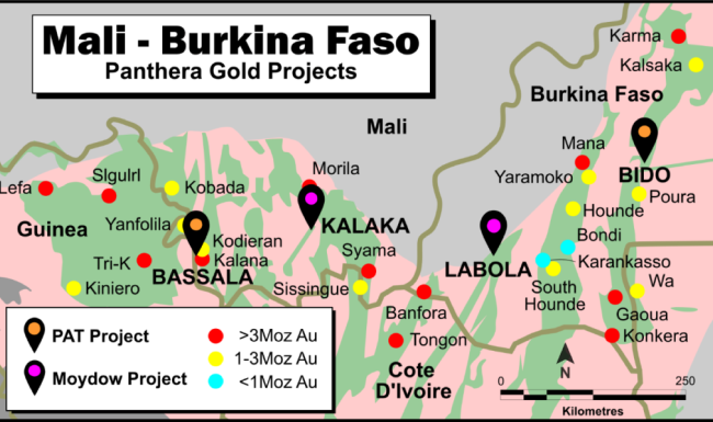
Location
Mali - Burkina Faso
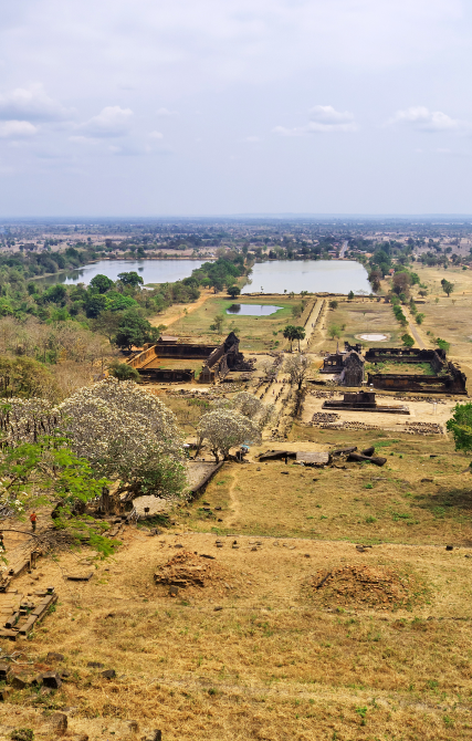
The Bassala project is located within a highly gold endowed Birimian volcano-sedimentary belt in southwestern Mali, approximately 200km south of the capital city Bamako (Figure 1). The belt hosts the Kalana (Endeavour Mining, 4Moz) and Kodieran (Wassoul’or, 2Moz) gold mines, both within 8-10km of the licence area.
The adjacent belt to the west is also well endowed with gold and hosts the Siguiri (AngloGold Ashanti (“AngloGold”), 17Moz), Tri-K (Avocet Mining, 3Moz), Kobada (African Gold Group, 3Moz), and Yanfolila (Hummingbird Resources, 2Moz) gold mines.

History and Geology
Project History and Geology
Whilst the licence hosts prolific artisanal mining activity, the only significant previous systematic exploration was undertaken by AngloGold during the period 2010-2011. That work consisted of broad spaced soil sampling at 800m x 100m spacing with limited infill to 400m x 50m and 200m x 50m spacing in selected areas.
It identified several gold in soil anomalies but it was difficult to interpret major trends due to the broad sample spacing.
The surface sampling campaign was followed up by selective shallow trenching designed to investigate beneath the laterite cover. That work was unsuccessful due to the thickness of the laterite.
Revealed Indicators
Mineral Discoveries Revealed
- 21m 1.15g/t Au from 15m including 3m
- 15m 0.56g/t Au from 3m to the end of the hole
- 3m 0.78g/t Au from 21m to the end of the hole
- 6m 0.49g/t Au from 39m to the end of the hole
- 3m 1.55g/t Au from 9m
- 3m 1.16g/t Au from surface
Refined Gold Trends
Improved Definition of Gold Mineralization Trends
Work conducted to date by Panthera has consisted of systematic soil sampling at 200m x 100m spacing (Figures 2 & 5) combined with detailed regolith mapping as shown in. This more detailed sampling has resulted in a much better definition of gold mineralisation trends, especially when interpreted in light of the regolith mapping.
It is now apparent that the main trend is roughly north-south with the only significant gaps in the anomalous trend being due to depositional regimes associated with recent alluvium that mask any underlying gold mineralisation.
Near-Source Gold Discovery
Recent Finds by Artisanal Miners
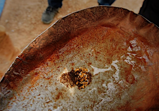
Artisanal miners have recently obtained some coarse angular gold from these workings suggesting it is close to the original bedrock source
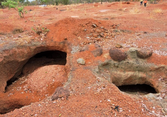
Artisanal Workings beneath Laterite Hardpan
Coarse Angular Gold from Artisanal Panning
9km Strike Close to Key Sites
Major Gold Target Defined Near Mines
This recent work, when combined with the previous AngloGold RAB drilling, defines a large gold target in excess of 9km long in an almost north-south direction and within 8-10 km of two operating gold mines with gold endowments of 2Moz and 4Moz respectively.
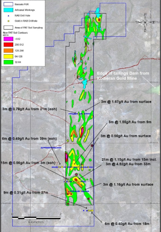
Panthera Soil Sampling Results with Anglogold RAB Drilling Overlaid
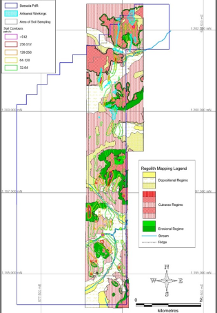
Bassala Regolith Map with Soil Sample Contours Overlaid
Projects
Our Other Projects
Inferred resourse volume
Gold Concentration
Current gold resource
Exploration Target


Get in Touch
Contact us
Leave the number and we will call you back